Serrana Bank.
The territory[]
The Territory Bajo Nuevo Bank, Serranilla Bank, Serrana Bank and Alice Shoal consist of various related eponymous and noneponymous banks, reefs, cays, shoals and sandbars.
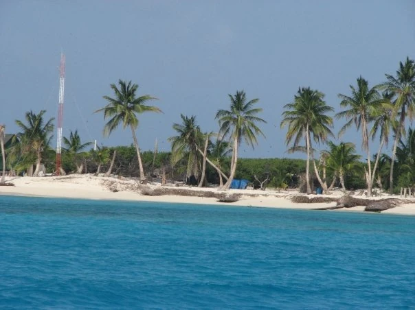
- Serrana Bank 14°20′N 80°20′W
- Southwest Cay (500 by 200 meters)
- South Cay (150 by 25 meters)
- Little Cay (less than 100 meters in diameter)
- East Cay (80 by 40 meters)
- Narrow Cay
- North Cay
- Quita Sueño Bank 14°28′57.2298″N 81°7′39.7632″W
- Roncador Bank 13°34′N 80°04′W
- Roncador Cay 13°32′N 80°03′W
- Serranilla Bank 15°50′N 79°50′W
- Beacon Cay 15°50′N 79°50′W
- Thunder Knoll (reef) 16°27′N 80°20′W (18 km)
- Rosalind Bank, 16°26′N 80°31′W. ( 300 km (186 mi))
- Alice Shoal 16°05′N 79°22′W.
- Bajo Nuevo Bank, 15°53′N 78°38′W
- Low Cay at 15°51′N 78°38′W. (2 metres (6.6 ft))
History[]
Serrana Bank is believed to be named after the Spanish castaway Pedro Serrano. It was first shown on a Dutch map in 1545 with this name. They were mapped more extensively by the English in 1660.
On November 19, 2012, in regard to Nicaraguan claims to the islands the International Court of Justice (ICJ) found, unanimously, that the Republic of Colombia has sovereignty over Serrana Bank.
Roncador Bank is a mostly-submerged atoll with several sandy cays. It lies in the west Caribbean Sea off the coast of Central America. It was originally claimed by the United States under the Guano Islands Act of 1856, as were all the islands between 1856 and 1895. In 1894, the USS Kearsarge was shipwrecked on Roncador Bank.
An old disused American lighthouse is at its northern end. A new Colombian lighthouse has been operating since 1977 on the southern end.
The Serranilla Bank was first shown on Spanish maps in 1510 as Placer de la Serranilla. It was mentioned by Louis-Michel Aury whose ship was shipwrecked on it in 1820.
In later history it has been the subject of conflicting claims made by a number of sovereign states. In most cases, the dispute stems from attempts by a state to expand its exclusive economic zone over the surrounding seas.
Rosalind Bank, also called Rosalinda or Rosa Linda Bank (Spanish: Placer de Rosalinda), is a large, completely submerged bank or atoll that lies with its southern extremity 269 km (1677 mi) ENE of Cabo Gracias a Dios, at 16°26′N 80°31′W.
The bank area is part of an extensive structure that continues further east through Pedro Bank towards Jamaica and is known as Nicaraguan Rise.
Several countries claim that their and EEZ extend over Rosalind Bank, included Colombia, Nicaragua, Honduras, the United States, and Jamaica so as to get exclusive fishing rights in the region.
Alice Shoal (Spanish: Banco Alicia or Bajo Alicia) is a wholly submerged reef, located in the western Caribbean Sea, about 260 kilometres (160 miles) southwest of Jamaica. The mainland of Colombia lies 740 kilometres (460 miles) away to the southeast.
Bajo Nuevo Bank, also known as the Petrel Islands (Spanish: Bajo Nuevo, Islas Petrel), is a small, uninhabited reef with some small grass-covered islets, with a lighthouse on Low Cay.
The reef was first shown on Dutch maps dating to 1634 but was given its present name in 1654. Bajo Nuevo was rediscovered by the English pirate John Glover in 1660.
On September 8, 1972, talks were held in Bogata. Here a deal was secured by Dominican Republic, Haiti, Costa Rica, Panamá, Honduras, Nicaragua, Jamaica, Colombia, Venezuela, Spain, France, the UK, the USA and the Netherlands diplomats on the issue of who could own the islands and EEZ. They agreed to internationalise the EEZ and they all share it out equally. The islands became a Colombian territory for legal reasons, such as stopping drug smuggling, but all the other claimant nations still have limited access to them.
On September 3, 2007 the eye of Category 5 Hurricane Felix passed over Serrana Bank.
Ownership[]
The EEZ is an internationalised zone and the claimant nations share it out equally. The islands themselves became a Colombian territory for legal reasons, such as stopping drug smuggling, but all the other claimant nations still have limited access to them.
Fish[]
It is inside a modestly productive fishing (mostly lobsters) zone, but the sea bead contains no meaningful mineral reserves and only small amounts of hydrocarbon fuels.